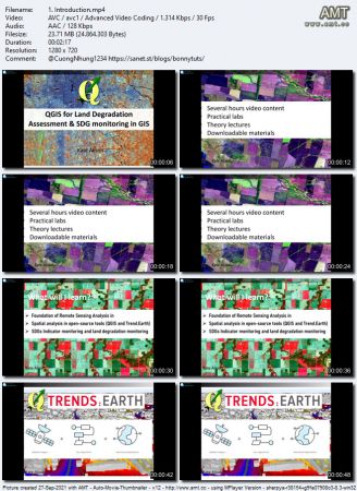
Udemy - QGIS for Land Degradation Assessment & SDG monitoring in GIS

seeders: 5
leechers: 5
updated:

Download Fast Safe Anonymous
movies, software, shows...

Files

[ FreeCourseWeb.com ] Udemy - QGIS for Land Degradation Assessment & SDG monitoring in GIS
  • Get Bonus Downloads Here.url (0.2 KB)
  • ~Get Your Files Here ! 1. Introduction
    • 1. Introduction.mp4 (23.7 MB)
    • 1. Introduction.srt (2.8 KB)
    • 2. Sustainable Development Agenda & Land Degradation Indicators.mp4 (28.4 MB)
    • 2. Sustainable Development Agenda & Land Degradation Indicators.srt (3.4 KB)
    2. Introduction to software used in this course QGIS
    • 1. About open-source QGIS software.mp4 (35.7 MB)
    • 1. About open-source QGIS software.srt (7.0 KB)
    • 2. QGIS version information.mp4 (17.7 MB)
    • 2. QGIS version information.srt (2.5 KB)
    • 3. Lab 1 QGIS installation.mp4 (86.7 MB)
    • 3. Lab 1 QGIS installation.srt (14.3 KB)
    • 4. Trends.Earth Plugin for QGIS.mp4 (26.2 MB)
    • 4. Trends.Earth Plugin for QGIS.srt (3.4 KB)
    • 5. Installation of Trends.Earth Plugin.mp4 (23.9 MB)
    • 5. Installation of Trends.Earth Plugin.srt (3.1 KB)
    3. Remote Sensing Crash Course
    • 1. Section Overview.mp4 (3.8 MB)
    • 1. Section Overview.srt (1.2 KB)
    • 2. Introduction to satellite images.mp4 (58.4 MB)
    • 2. Introduction to satellite images.srt (13.2 KB)
    • 3. Sensors and Platforms.mp4 (18.3 MB)
    • 3. Sensors and Platforms.srt (5.9 KB)
    • 4. How to work with the Remote Sensing images preprocessing.mp4 (55.1 MB)
    • 4. How to work with the Remote Sensing images preprocessing.srt (12.3 KB)
    • 5. Installation of Semi-Automated LCassification PlugIn.mp4 (18.4 MB)
    • 5. Installation of Semi-Automated LCassification PlugIn.srt (3.6 KB)
    • 6. Lab 2 Layerstacking, True and False Colour composites.mp4 (160.9 MB)
    • 6. Lab 2 Layerstacking, True and False Colour composites.srt (16.3 KB)
    • 7. Lab 3 Image preprocessing - atmospheric correction.mp4 (97.2 MB)
    • 7. Lab 3 Image preprocessing - atmospheric correction.srt (8.6 KB)
    • 8. Sources of Remote Sensing images for LULC mapping.mp4 (84.2 MB)
    • 8. Sources of Remote Sensing images for LULC mapping.srt (12.7 KB)
    • Landsat5_Rainforest_orig
      • lt52300691985196cub00_b1.tif (4.2 MB)
      • lt52300691985196cub00_b2.tif (4.2 MB)
      • lt52300691985196cub00_b3.tif (4.2 MB)
      • lt52300691985196cub00_b4.tif (4.2 MB)
      • lt52300691985196cub00_b5.tif (4.2 MB)
      • lt52300691985196cub00_b7.tif (4.2 MB)
      • lt52300691985196cub00_mtl.txt (64.0 KB)
      • readme.txt (0.2 KB)
      Landsat_8_orig
      • lc82300692013209lgn00_b2.tif (8.4 MB)
      • lc82300692013209lgn00_b3.tif (8.4 MB)
      • lc82300692013209lgn00_b4.tif (8.4 MB)
      • lc82300692013209lgn00_b5.tif (8.4 MB)
      • lc82300692013209lgn00_b6.tif (8.4 MB)
      • lc82300692013209lgn00_b7.tif (8.4 MB)
      • lc82300692013209lgn00_mtl.txt (7.6 KB)
      • readme.txt (0.2 KB)
      4. Use of QGIS for Land Degradation Assessment according to SDGs requirements
      • 1. Introduction to sustainable agenda and Land Degradation.mp4 (68.2 MB)
      • 1. Introduction to sustainable agenda and Land Degradation.srt (8.2 KB)
      • 2. Register in Trends.Earth Plugin.mp4 (7.3 MB)
      • 2. Register in Trends.Earth Plugin.srt (2.0 KB)
      • 3. Downloading geospatial data with Trends.Earth Plugin -Example of Land Cover Data.mp4 (41.3 MB)
      • 3. Downloading geospatial data with Trends.Earth Plugin -Example of Land Cover Data.srt (7.9 KB)
      • 4. How to load downloaded data to QGIS - Example of Land Cover Product from ESA.mp4 (44.3 MB)
      • 4. How to load downloaded data to QGIS - Example of Land Cover Product from ESA.srt (4.5 KB)
      • 5. Where to get help on Trends.Earth.mp4 (19.2 MB)
      • 5. Where to get help on Trends.Earth.srt (2.4 KB)
      • 6. Lab Land degradation assessment in QGIS with Trends.Earth - Hands-On.mp4 (104.3 MB)
      • 6. Lab Land degradation assessment in QGIS with Trends.Earth - Hands-On.srt (14.8 KB)
      • 7. Computation of SDG 15.3.1 Land Degradation Indicator, statistics & reporting.mp4 (42.8 MB)
      • 7. Computation of SDG 15.3.1 Land Degradation Indicator, statistics & reporting.srt (5.1 KB)
      5. Project Assignment
      • 1. Your Independent Project.mp4 (13.0 MB)
      • 1. Your Independent Project.srt (1.3 KB)
      • 2. Bonus.mp4 (5.9 MB)
      • 2. Bonus.srt (1.3 KB)
      • Bonus Resources.txt (0.3 KB)

Description

QGIS for Land Degradation Assessment & SDG monitoring in GIS


MP4 | Video: h264, 1280x720 | Audio: AAC, 44.1 KHz, 2 Ch
Genre: eLearning | Language: English + srt | Duration: 24 lectures (2h 21m) | Size: 952.2 MB
Conduct Remote Sensing & GIS for Land Degradation Assessment & Sustainable Development Goals (SDGs) Indicators
What you'll learn:
Students will learn to work in TrendsEarth in QGIS
To learn how to conduct land degradation analysis in QGIS
Get informed about Sustainable Development Agenda and Sustainable Development Indicators (SDGs)
Learn basics of Remote Sensing and how to apply Remote Sensing analysis in open-source tools
Complete your independent land degradation project using geospatial approaches in QGIS

Requirements
A working computer with internet connection
An interest in working with spatial data and GIS

Description
This course is designed to take users who use GIS for basic geospatial data/GIS/Remote Sensing analysis to perform land degradation assessment and monitoring Sustainable Development Goals (SDGs) Indicator 15.3 'Proportion of Degraded Land' with Big Data on the cloud using QGIS! The course will also focus on introducing you to sustainable development goals (SDG) indicators computation using the TrendsEarth plugin in QGIS. I will also introduce you to user-intuitive cloud computing using EO-browser!

This course provides you with all the necessary knowledge to start and advance your skills with Geospatial analysis and includes several hours of video content, plenty of practical analysis, and downloadable materials. After taking this course, you will be able to implement PRACTICAL, real-life spatial geospatial analysis for Land Degradation applications, and tasks with the Big Data in QGIS.


Download torrent
1.1 GB
seeders:5
leechers:5
Udemy - QGIS for Land Degradation Assessment & SDG monitoring in GIS


Trackers

tracker name
udp://tracker.torrent.eu.org:451/announce
udp://tracker.tiny-vps.com:6969/announce
http://tracker.foreverpirates.co:80/announce
udp://tracker.cyberia.is:6969/announce
udp://exodus.desync.com:6969/announce
udp://explodie.org:6969/announce
udp://tracker.opentrackr.org:1337/announce
udp://9.rarbg.to:2780/announce
udp://tracker.internetwarriors.net:1337/announce
udp://ipv4.tracker.harry.lu:80/announce
udp://open.stealth.si:80/announce
udp://9.rarbg.to:2900/announce
udp://9.rarbg.me:2720/announce
udp://opentor.org:2710/announce
µTorrent compatible trackers list

Download torrent
1.1 GB
seeders:5
leechers:5
Udemy - QGIS for Land Degradation Assessment & SDG monitoring in GIS


Torrent hash: 2AFB8B72A25F17D197ED7035243862AE3CE19A23