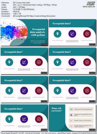
Udemy - Geospatial data analysis with python

seeders: 13
leechers: 8
updated:

Download Fast Safe Anonymous
movies, software, shows...
  • Downloads: 92
  • Language: English

Files

[ FreeCourseWeb.com ] Udemy - Geospatial data analysis with python
  • Get Bonus Downloads Here.url (0.2 KB)
  • ~Get Your Files Here ! 01 Introduction
    • 001 Course intro.en.srt (2.5 KB)
    • 001 Course intro.mp4 (10.7 MB)
    • 002 Introduction to google colab.en.srt (4.0 KB)
    • 002 Introduction to google colab.mp4 (20.4 MB)
    • 003 Notebooks for this course.html (1.5 KB)
    • dataset csv
      • population.csv (2.4 KB)
      geojson
      • municipality.json (9.5 MB)
      geotiff
      • MODIS_18Dec17_NIR.tif (22.3 KB)
      • MODIS_18Dec17_RED.tif (22.9 KB)
      • MODIS_18Nov02_NIR.tif (19.2 KB)
      • MODIS_18Nov02_RED.tif (17.6 KB)
      • nepal_lc_2020.tif (492.6 KB)
      • srtm_57_08_1.tif (17.2 MB)
      shp
      • municipality.dbf (293.0 KB)
      • municipality.prj (0.1 KB)
      • municipality.sbn (7.6 KB)
      • municipality.sbx (0.6 KB)
      • municipality.shp (3.9 MB)
      • municipality.shp.xml (9.1 KB)
      • municipality.shx (6.1 KB)
      • pokhara.cpg (0.0 KB)
      • pokhara.dbf (0.9 KB)
      • pokhara.prj (0.1 KB)
      • pokhara.sbn (0.1 KB)
      • pokhara.sbx (0.1 KB)
      • pokhara.shp (10.3 KB)
      • pokhara.shp.xml (9.1 KB)
      • pokhara.shx (0.1 KB)
      02 Vector data analysis
      • 001 Overview of this section.en.srt (4.1 KB)
      • 001 Overview of this section.mp4 (5.5 MB)
      • 002 required dataset.html (1.0 KB)
      • 003 Installation of geopandas.en.srt (2.2 KB)
      • 003 Installation of geopandas.mp4 (16.8 MB)
      • 004 Reading vector data.en.srt (8.2 KB)
      • 004 Reading vector data.mp4 (63.8 MB)
      • 005 Reading the metadata of the geodataframe.en.srt (1.9 KB)
      • 005 Reading the metadata of the geodataframe.mp4 (13.0 MB)
      • 006 Visualization of vector data.en.srt (4.8 KB)
      • 006 Visualization of vector data.mp4 (37.1 MB)
      • 007 writing vector data.en.srt (4.9 KB)
      • 007 writing vector data.mp4 (37.9 MB)
      • 008 Working with attribute table.en.srt (11.3 KB)
      • 008 Working with attribute table.mp4 (81.9 MB)
      • 009 Working with geometry (Shapely).en.srt (9.9 KB)
      • 009 Working with geometry (Shapely).mp4 (68.9 MB)
      • 010 Dissolve municipality into district.en.srt (6.0 KB)
      • 010 Dissolve municipality into district.mp4 (46.2 MB)
      • dataset geojson
        • municipality.json (9.5 MB)
        shp
        • municipality.dbf (293.0 KB)
        • municipality.prj (0.1 KB)
        • municipality.sbn (7.6 KB)
        • municipality.sbx (0.6 KB)
        • municipality.shp (3.9 MB)
        • municipality.shp.xml (9.1 KB)
        • municipality.shx (6.1 KB)
        03 Case study on vector data
        • 001 Notebook for this course.html (1.3 KB)
        • 002 Statement of problem.en.srt (1.2 KB)
        • 002 Statement of problem.mp4 (3.0 MB)
        • 003 Solution.en.srt (13.3 KB)
        • 003 Solution.mp4 (124.4 MB)
        • 015 population.csv (2.4 KB)
        04 Basic of raster data analysis
        • 001 Land cover data download (optional).en.srt (4.2 KB)
        • 001 Land cover data download (optional).mp4 (45.6 MB)
        • 002 Rasterio installation.en.srt (3.1 KB)
        • 002 Rasterio installation.mp4 (18.9 MB)
        • 003 Reading raster dataset.en.srt (4.2 KB)
        • 003 Reading raster dataset.mp4 (29.5 MB)
        • 004 Reading metadata of raster.en.srt (7.0 KB)
        • 004 Reading metadata of raster.mp4 (11.9 MB)
        • 005 Visualization of raster data.en.srt (5.9 KB)
        • 005 Visualization of raster data.mp4 (45.7 MB)
        • 006 Writing tiff file.en.srt (5.5 KB)
        • 006 Writing tiff file.mp4 (42.5 MB)
        • 007 Mathematical operation with raster.en.srt (3.8 KB)
        • 007 Mathematical operation with raster.mp4 (25.5 MB)
        05 Raster data analysis (Advance)
        • 001 Masking the tiff file with shapefile.en.srt (9.1 KB)
        • 001 Masking the tiff file with shapefile.mp4 (85.2 MB)
        • 002 Raster reclassification.en.srt (9.2 KB)
        • 002 Raster reclassification.mp4 (83.9 MB)
        • 003 Raster resampling.en.srt (11.6 KB)
        • 003 Raster resampling.mp4 (96.5 MB)
        • 004 Raster reprojection.en.srt (7.7 KB)
        • 004 Raster reprojection.mp4 (69.1 MB)
        • 005 NDVI calculation.en.srt (5.5 KB)
        • 005 NDVI calculation.mp4 (54.3 MB)
        • 006 Correction on NDVI calculation.en.srt (1.5 KB)
        • 006 Correction on NDVI calculation.mp4 (14.0 MB)
        • 007 Bonus lecture.html (2.7 KB)
        • Bonus Resources.txt (0.3 KB)

Description

Geospatial data analysis with python


MP4 | Video: h264, 1280x720 | Audio: AAC, 44.1 KHz, 2 Ch
Genre: eLearning | Language: English + srt | Duration: 30 lectures (2h 57m) | Size: 1 GB
Learn how to read, write and visualize the raster/vector dataset and perform spatial analysis using python
What you'll learn:
Reading and writing of geospatial data
Visualization of geospatial data using python
Benefits of python over GIS software
Resampling, reprojection, reclassification of data
Most essential geospatial libraries
Essential things for geopandas, fiona, shapely, rasterio etc

Requirements
Basic programming knowledge
Basic understanding about the geospatial data

Description
Geospatial data is also known as spatial data. It contains the locational information of the things or objects. In this course, we are going to read the data from various sources (like from spatial database) and formats (like shapefile, geojson, geo package, GeoTIFF etc), perform the spatial analysis and try to find insights for spatial data. In this course, we lay the foundation for a career in the Geospatial community.

Here is the list of topics that I covered in this course,


Download torrent
1.2 GB
seeders:13
leechers:8
Udemy - Geospatial data analysis with python


Trackers

tracker name
udp://tracker.torrent.eu.org:451/announce
udp://tracker.tiny-vps.com:6969/announce
http://tracker.foreverpirates.co:80/announce
udp://tracker.cyberia.is:6969/announce
udp://exodus.desync.com:6969/announce
udp://explodie.org:6969/announce
udp://tracker.opentrackr.org:1337/announce
udp://9.rarbg.to:2780/announce
udp://tracker.internetwarriors.net:1337/announce
udp://ipv4.tracker.harry.lu:80/announce
udp://open.stealth.si:80/announce
udp://9.rarbg.to:2900/announce
udp://9.rarbg.me:2720/announce
udp://opentor.org:2710/announce
µTorrent compatible trackers list

Download torrent
1.2 GB
seeders:13
leechers:8
Udemy - Geospatial data analysis with python


Torrent hash: 4F36F377BC55A2AECE4F88EFF510FA9B0B986801